GPS Track Files
GPS Track files are a standard way to represent coordinate data from a GPS device. The points of reference
represent a path taken by a hiker and can be shared with others so that they can follow their virtual
breadcrumbs and retrace their footsteps.
Austin Explorer allows users to download track files for use on their own GPS receivers and
to upload their own track files for others to enjoy.

Q. What's GPS?
A. GPS stands for Global Position System. It is a
satellite system launched by the US government that provides relatively accurate positioning anywhere on
the planet. A GPS receiver (sometimes referred to as GPSr) can be used to provide the longitude and
latitude describing its position on the Earth.
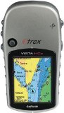
 Many of today's GPS receivers are handheld and can be taken on the trail just about anywhere. They can periodically
record a location and construct a string of points detailing the path travelled. This path in the form of a track
file can be shared with others.
Many of today's GPS receivers are handheld and can be taken on the trail just about anywhere. They can periodically
record a location and construct a string of points detailing the path travelled. This path in the form of a track
file can be shared with others.
Q. What GPS track file formats does Austin Explorer support?
A. We support both GPX and
TCX standard track files. These are the
two most commonly supported standards to exchange data between GPS receivers and software packages.
Austin Explorer supplies .gpx or .tcx files for some of the hikes highlighted
on the site so that you can find the trails more easily.
Q. How do I use a track file from the site?
A. Look for the "Download Track File" option in the "Take Action" box in the upper right quadrant of the hike details page and click to down it.
Save it to your computer. From this point on you'll have to refer to the documentation that came with your GPS receiver. Each brand has different
software that comes with it for performing tasks like this. Alternately, you can use a third party tool for transferring GPX or TCX files to your GPS device,
such as GPS Utility.